
LANDSCAPE PROFILE
Watamu
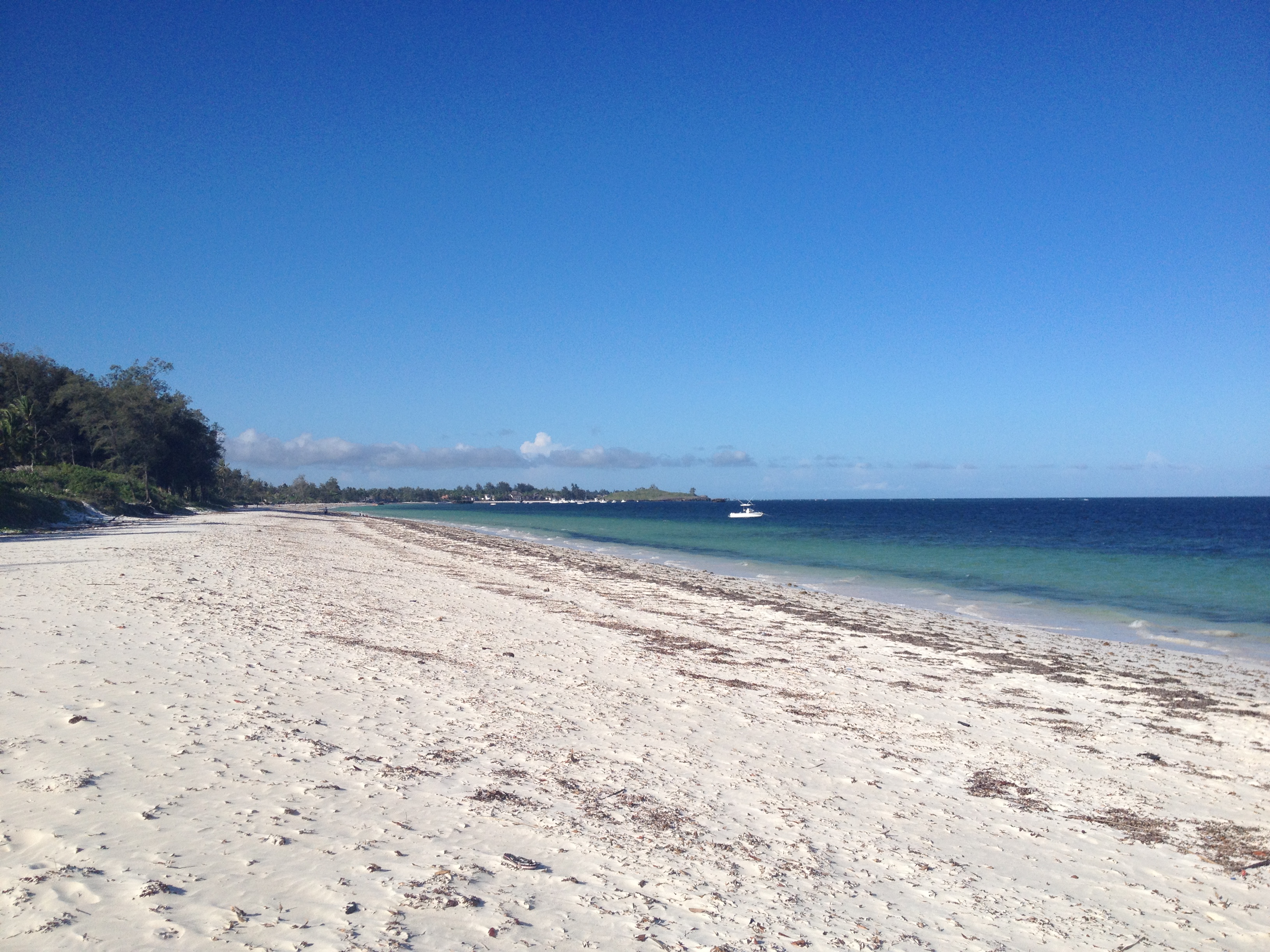
A coastal mosaic on the Kenyan Indian Ocean shore: coral reefs, mangroves, sea turtles, and East Africa's last great coastal forest, all within a small radius of one tourism town.
Watamu ward · Kilifi County · Coastal Kenya
An independent Pandion reading. We observe and synthesise this landscape through our sustainability framework. We are not a managing or governing body, and there is no established implementing partnership in this landscape.
PROFILE
A coastal landscape on Kenya's Indian Ocean shore: Watamu Marine National Park, Mida Creek's mangrove estuary, and East Africa's largest remaining coastal forest, all within a few kilometres of one another.
Watamu is a small coastal town in Kilifi County on Kenya's Indian Ocean shore, ~120 km north of Mombasa. Its significance is out of proportion to its size: within a radius of about 10 km it holds Watamu Marine National Park (established 1968, one of the oldest in Africa), the Marine Reserve, the Mida Creek mangrove estuary (Ramsar-listed since 1990, seven species of mangrove), and the adjacent Arabuko Sokoke Forest (~420 km², the largest remaining coastal indigenous forest in East Africa, a UNESCO Biosphere Reserve). The local economy is tourism-led (beach resorts, dive operators, sea turtle ecotourism) with artisanal fisheries underneath. Climate vulnerability is real: 1998 and 2016 saw major coral bleaching events, sea-level rise is gradually reshaping Mida Creek, and ocean warming pressures the reef and fisheries.
The framework's analytical scope is Kilifi County, the devolved unit under Kenya's 2010 constitution that has primary domestic governance authority. The focal landscape is the Watamu-Mida peninsula, centred on Dongokundu and Kisiwani villages on the southern shore of Mida Creek (both in Dabaso ward). The exact boundary is intentionally open while we work it through: Mida Creek is the natural northern edge, but how far the landscape reaches south along the peninsula, west toward the Arabuko Sokoke forest edge, or east into the marine system is something to settle with local partners rather than draw on a map first. The orientation is clear, however: south of Watamu town, on and around Mida Creek, rather than north toward Malindi where Watamu ward itself extends. The conservation infrastructure across the wider system is unusually mature for a small coastal landscape: A Rocha Kenya, Local Ocean Conservation, the Watamu Marine Association, and Kenya Wildlife Service all operate locally. Any landscape-scale work would be a convening exercise across an established ecosystem, not the construction of one from scratch.
The faded outer boundary is Kilifi County (OSM relation 3495545, ODbL): the framework's analytical scope under Kenya's devolved county structure. There is intentionally no inner focal boundary yet. The focal landscape sits south of Watamu town on the Mida peninsula, centred on Dongokundu and Kisiwani villages with Mida Creek as the natural northern edge, but how far it extends south along the peninsula, west toward Arabuko Sokoke, or east into the marine system is left open while we work it through with local partners. Toggle on the protected-area, settlement and hospitality layers to see the human-and-natural mosaic that gives the landscape its shape.
GOVERNANCE & JURISDICTION
Where this sits in Kenya’s devolved governance hierarchy.
Watamu sits within Kenya's devolved governance structure under the 2010 constitution. The administrative chain runs from the Republic through Kilifi County and Kilifi North sub-county to the ward (Dabaso, where the focal villages sit), and beneath that the sub-location and the informal village tier. Formal boundary mapping thins as you descend: sub-locations exist as the smallest formally bounded administrative units but most are unpublished as GIS, and villages like Dongokundu and Kisiwani are informal place-names with no formal polygon boundary in any Kenyan system. Four parallel statutory frameworks overlay this administrative spine (cadastral, protected areas, county land-use planning, and fisheries co-management). The notes below the timeline pick these up.
THROUGH THE FRAMEWORK
The framework, applied to this place.
Our sustainability framework reads each landscape across layers, flows, cross-cutting enablers, and actors. Below: the headline insight from each, applied to Watamu. First-pass; deepens iteratively.
L1
layer
Planetary Foundations
Climate-vulnerable Indian Ocean coast. 1998 and 2016 coral bleaching events are the defining recent climate signals; sea-level rise is the structural threat to Mida Creek and the low-lying coast.
L2
layer
Landscapes & Jurisdictions
Devolved governance: Kilifi County under Kenya's 2010 constitution. National-level marine and forest authorities (KWS, KFS) operate in parallel. Watamu sits within Kilifi North sub-county, Watamu ward.
L3
layer
Ecosystem Services
Marine, mangrove, seagrass and coastal forest services all present within a tight radius. Tourism captures part of the value; nature markets capture almost none. The Vanga Blue Forest precedent shows mangrove blue carbon is operable in this regulatory environment.
L4
layer
Policy & Governance
Mature Kenyan policy frame: Climate Change Act 2016, Forest Conservation & Management Act 2016, Wildlife Conservation & Management Act 2013, Fisheries Management & Development Act 2016. Carbon market regulation is being clarified; Beach Management Units provide a fisheries co-management structure already in law.
L5
layer
Corporate Action / Enterprise Development
Tourism is the corporate landscape. Hotel and resort decarbonisation, reef-positive concierge positioning, and operator-level conservation contributions are the natural L5 surface. The dive industry and turtle ecotourism are concrete sustainability-positive enterprise types already in operation.
Capital Flows
flow
Capital
Capital pathways are well-developed for Kenya: GCF country envelope, Darwin Initiative, UNDP-GEF SGP, Adaptation Fund, Africa Climate Foundation. Blue carbon is the most concrete emergent revenue mechanism, gated on Mida Creek baselining and KWS / county alignment.
Data Flows
flow
Data
Unusually rich for a small landscape: A Rocha Kenya has decades of Mida Creek monitoring, KWS holds Marine NP data, CORDIO East Africa publishes reef condition assessments. Open-data starting points (Allen Coral Atlas, Global Mangrove Watch) layer on top.
Cross-Cutting
cross cutting
Enabling Systems
Multiple established actors operate locally — A Rocha Kenya, Local Ocean Conservation, KWS, the county government and the hotel sector among them. Whether they cohere into a working landscape-scale convening structure (or one would need to be assembled) is an open question requiring local verification.
Cross-Cutting
cross cutting
Social Sustainability
Tourism-dependent local economy with significant artisanal fishing communities. Coastal community land rights are politically sensitive in Kenya (the Mijikenda land question). Any benefit-sharing design has to read this carefully.
Cross-Cutting
cross cutting
AI in Sustainability
Useful in the background: satellite reef bleaching monitoring, mangrove change detection, automated bird-call ID for Arabuko Sokoke, grant-writing for stretched NGOs. Not yet present locally as a frontline tool.
Actors
actors
Actor Ecosystem
Dense and well-connected for the landscape's size: Kenya Wildlife Service, A Rocha Kenya, Local Ocean Conservation, Kilifi County government, Kenya Forest Service, and the hotel sector. The actor map is short and mature — coordination is realistic, though the specific landscape-scale convening structure needs local verification.
STRATEGIC OPPORTUNITIES
Where capital, capacity and place could meet.
| Opportunity | Potential |
|---|---|
| Mida Creek mangrove blue carbon feasibility | Most concrete near-term opportunity. Vanga Blue Forest ~80 km south is the operational precedent; A Rocha Kenya holds the baseline data. Pre-feasibility scoping rather than direct project. |
| Reef restoration partnership (KWS + hotel sector) | Hotel-funded reef-monitoring and restoration programme; turns reef condition into a tourism-pricing premium. |
| Hotel-sector sustainability brief | Property-level sustainability positioning for an eco-leaning resort; pairs with reef-positive concierge proposition. |
| Sea turtle conservation programme support | Local Ocean Conservation has the operational programme; capacity bridge or analytical support rather than substitution. |
| Forest-reef ecosystem-service connectivity scoping | Few landscapes have Arabuko Sokoke's proximity to reef. Scoping how forest condition affects coastal water quality and reef resilience would be analytically distinctive. |
| Coastal community conservancy model adaptation | The Northern Rangelands Trust conservancy model is well-established inland. Adapting it to a marine-coastal context (Beach Management Units + community land structures) is an open opportunity. |
CAPITAL CONTINUUM
Stage 1: Incubation (mid)
Capital appropriate at this stage: Grants, philanthropy, technical assistance, capacity building; selective project finance where MRV-ready (mangrove blue carbon following the Vanga precedent). Kenya's mature climate-finance access opens GCF, Adaptation Fund, GEF SGP, Darwin Initiative.
Watamu sits mid Stage 1 on the Capital Continuum, ahead of TCI and well ahead of Krupanj. Counterparty infrastructure is mature (KWS, A Rocha Kenya, Local Ocean Conservation, Watamu Marine Association). Policy and legal framework is well-developed. The Vanga Blue Forest precedent ~80 km south demonstrates that blue carbon is operationally viable in this regulatory environment. What is missing is a specific Watamu-scale nature-market project in flight, with credible MRV anchored to local data partners.
POSITION ON THE LIFECYCLE
FIVE PILLARS OF INVESTMENT READINESS
Each pillar must be in place before this landscape can absorb scaling capital. Status reflects current observation, not aspiration.
Counterparty
IN PLACEThe strength and credibility of the project proponent, local implementing partners, and alignment of incentives across stakeholders.
Multiple credible local counterparties: KWS, A Rocha Kenya (with 25+ years of local presence and Mida Creek monitoring), Local Ocean Conservation. The strongest counterparty pillar of any Pandion landscape to date.
Anchored to framework: Actors
Policy & Legal
PARTIALNational and sub-national policy environment, regulatory clarity on carbon and land rights, security of approvals and agreements.
Mature regulatory framework (Climate Act 2016, Forest Act 2016, Wildlife Act 2013, Fisheries Act 2016). Devolved county functions are clearly defined. Carbon-market regulation is being clarified through the Climate Change (Amendment) Act 2023. Coastal land tenure has unresolved political sensitivities (the Mijikenda land question).
Anchored to framework: L4
ESG & SDG
PARTIALCommunity engagement legitimacy, safeguards, benefit-sharing arrangements, contribution to wider development goals.
Community engagement infrastructure exists locally through Beach Management Units and NGO partnerships. Implicit SDG alignment (13, 14, 15, 11, 8) is strong. No specific benefit-sharing design for a Pandion-anchored project yet.
Anchored to framework: Social Sustainability
Technical / Implementation
PARTIALMethodological credibility, baseline data quality, capacity to deliver at scale.
Unusually strong baseline data for a small landscape: A Rocha Kenya's decades of Mida Creek monitoring, KWS Marine NP data, CORDIO East Africa reef condition assessments. Capacity gap is project-specific: a defined Watamu-scale mangrove or reef project would need its own MRV protocol stack.
Anchored to framework: Data Flows
Commercial & Finance
EMERGINGFinancial model resilience, funding strategy, long-term viability of revenue streams.
No designed financial model for a Pandion-anchored project. Funding pathways well-identified (GCF, Darwin, UNDP-GEF SGP, Adaptation Fund, mangrove blue carbon). Vanga Blue Forest is the operational precedent for the most concrete revenue mechanism. Hotel-sector commercial proposition is under-explored.
Anchored to framework: Capital Flows
CRITICAL GATING ITEMS
The prerequisites that stand between this landscape and Stage 2 implementation capital. Each one gates a different pillar.
- 1Local convening conversation (A Rocha / KWS / Kilifi County)COUNTERPARTY
Watamu's strong counterparty pillar means a single convening conversation could surface where Pandion analytical capacity adds value vs duplicates existing capability. This is the first conversation, not the last.
- 2Mida Creek mangrove blue carbon pre-feasibilityTECHNICAL / IMPLEMENTATION
The most concrete near-term project opportunity. Pre-feasibility scoping (drawing on A Rocha Kenya baseline + Global Mangrove Watch + Vanga lessons) is the prerequisite for any project-level proposal.
- 3Reef-positive tourism proposition designCOMMERCIAL & FINANCE
Hotel-sector willingness to pay for reef condition is the under-explored commercial route. A design exercise paired with one operator-anchored pilot would test this without requiring full project finance.
- 4Kenya carbon-market regulation clarity scopingPOLICY & LEGAL
The Climate Change (Amendment) Act 2023 is clarifying carbon-market rules. A short legal scoping for how mangrove and reef-adjacent carbon assets would be treated would de-risk any subsequent project proposal.
- 5Coastal community-rights and benefit-sharing reviewESG & SDG
The Mijikenda land question and coastal community-rights framework need to be read carefully before any benefit-sharing design. Existing NGO partners (A Rocha Kenya, LOC) carry local legitimacy; their involvement would shape any Pandion role.
Framework source: Capital Continuum Advisers, Deploying Climate Finance Along the Capital Continuum (Berardo et al., March 2025) and the 5-Pillar Investment Readiness methodology (Kiss, Sept 2025).
CURRENT STATE
First-pass scaffold. Discovery stage; no active client engagement. The unusually mature local conservation ecosystem (A Rocha Kenya, KWS, Local Ocean Conservation) means any future Pandion involvement would be convening and analytical rather than delivery. Deepening would follow either a strategic decision to invest in Watamu, or a relationship trigger via the East African sustainability network.